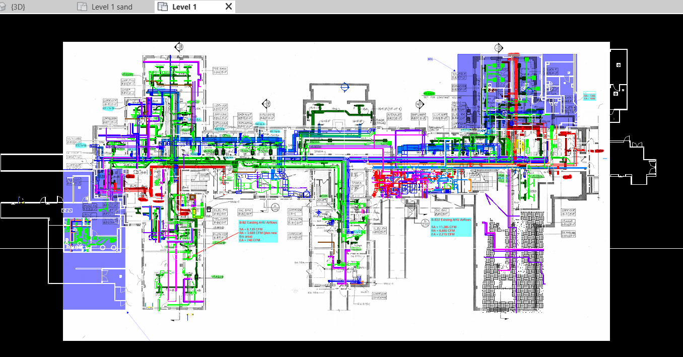
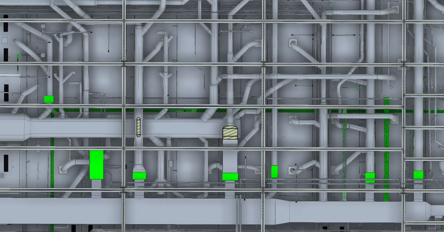
Point cloud data from laser scanning is an incredibly valuable tool in renovation planning. It captures precise 3D representations of spaces and structures, enabling architects, engineers, and contractors to make informed decisions. Laser scanning has become the preferred method for understanding complex MEP systems because the locations of pipes, ducts, electrical conduits, and structural elements are captured in millimeter-accurate point clouds.
Point Clouds: An Essential Tool for Above-Ceiling Projects
TYPICAL USE CASES:
Retrofit Planning: By simulating new installations (e.g., HVAC, piping, electrical) within the point cloud, teams can detect potential conflicts with existing structures before construction begins, reducing costly rework and delays.
Analysis for Leasing: Detailed spatial data allows teams to analyze the layout and optimize the placement of new equipment or partitions, ensuring efficient use of space and compliance with safety codes.
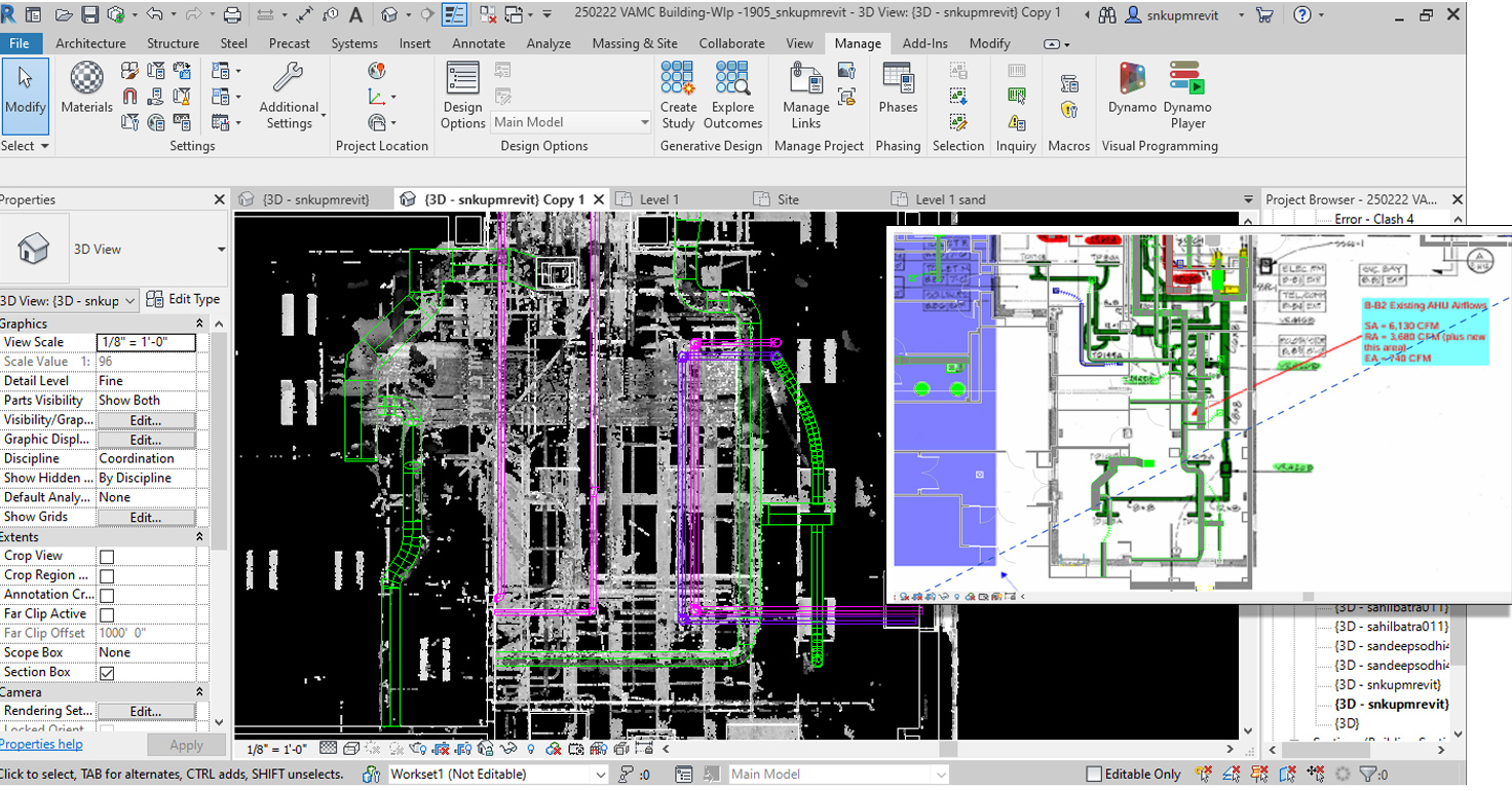
BIM integration: Data is exported to software like Autodesk Revit, where MEP engineers reference precise locations of structural elements, pipes, and conduits.
Construction/Compliance Documentation: Point clouds can be used to generate updated construction documents, including floor plans, sections, and elevations, which are essential for permitting and regulatory compliance.
COAST 2 COAST WORKFLOW:
Planning: Accessing the area above the ceiling often requires removing ceiling tiles, which can be disruptive and time-consuming for building owners. The Coast 2 Coast is unique in that our team does this for you, one area at a time, to minimize disruption to building occupants. This method allows work to be performed during normal operation or completed during off-hours without needing additional staff to remove and replace ceiling tiles.
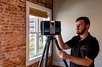
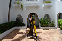
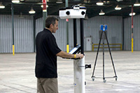
Capture: Coast 2 Coast technicians methodically work through the space, first capturing layout details below the ceiling, then removing ceiling tiles to scan above. Typically, we will use several pieces of equipment to promote efficiency and boost accuracy. The team scans in multiple places at multiple angles to avoid obstructions and ensure the point cloud is complete. If areas are inaccessible due to obstructions, safety concerns, or operational constraints, our experts will make field notes and can also reference file drawings for site verification. The point cloud can include custom datum points to integrate with an existing Coordinate System.
Processing: We use specialized equipment and software to process the massive point cloud datasets. Further manual verification for dark or reflective materials and components ensures data integrity is not affected.
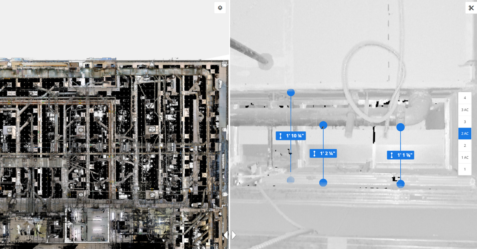
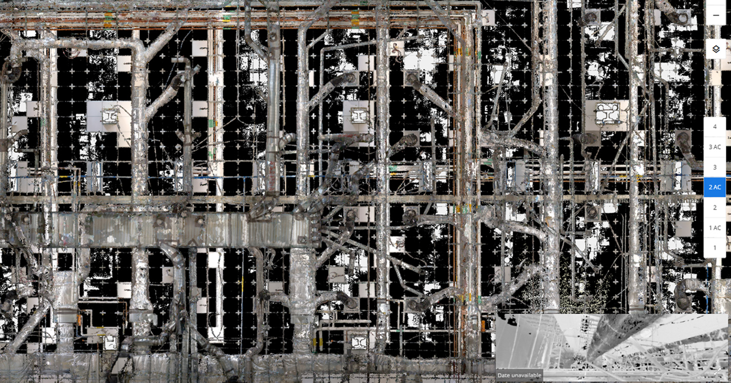
Delivery: The unified point cloud can be delivered in industry-standard file formats for integration into common software or accessed via an online platform with functionality to view, measure, and make annotations.
REAL WORLD EXAMPLE:
Expect the Unexpected… Finding a Double Ceiling during Lab Retrofit
The high level of detail captured in the point cloud can serve as a stand-alone data repository to locate items of interest and/or identify additional requirements.
In this example, our team laser-scanned the building in phases to accommodate existing tenant schedules and the removal of proprietary equipment. Upon completing the fieldwork, the design team utilized the point cloud as a visualization tool even before modeling work began. The virtual walk-through of the data revealed a particularly complex above-ceiling, double-height infrastructure. This continuous view of the structural details, ductwork, piping, and electrical systems so early in the process enabled engineers to modify retrofit requirements without impacting the project timeline.
The final Revit model, together with the point cloud and virtual tour, helped the design team to anticipate construction challenges and implement a more resilient design strategy.
REAL WORL EXAMPLE:
Fill in the Gaps… Advanced Techniques and Data Augmentation for Hospital HVAC Upgrade
Integrating new upgrades into old systems can represent a cost-saving while still providing significant improvements. But it is not without challenges. With precise 3D visualizations, engineers can design custom transitions, supports, and connections for new HVAC components that align perfectly with existing ductwork.
Structural elements, ductwork, pipes, and other components can obstruct the scanner’s line of sight. In this example, to avoid occlusions and shadows in the point cloud, technicians scanned from multiple positions and created field notes to document obstructions they encountered. In areas that proved inaccessible due to operational constraints, old drawings were included to convey the original design and how the system was assumed to continue. Viewing the point cloud in this non-continuous method further highlighted design constraints and structural limitations. The data provided the design team with better information to assess the feasibility of designs and the best way to integrate a modern system into the older building.