

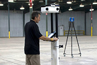
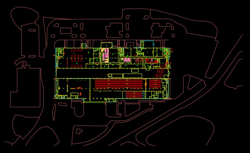
The objective of this Naval Station project was to verify and update floor plans, delineate workspaces, and collect workspace attribute data. As the field team for the prime contractor, Coast 2 Coast surveyed more than 100 buildings (including equipment shops, offices, and warehouses) totaling 6.8 million Sq. Ft. in less than 60 days.
Coast 2 Coast staff members visited each facility and verified exterior and interior building dimensions. Where there were discrepancies in previous architectural drawings, field staff modified the CAD drawing to ensure it accurately represented field conditions. Coast 2 Coast documented additional space management data and metadata based on specified NAVFAC CAFM, Space Management, and GRC standards. The team completed 100% of the onsite data capture and was responsible for populating an internal object data table for each space polygon within the CAD floor plan. Data gathered for each space included facility number, net square footage, seat count, utilization ID, and space function code.